reedmaniac.com
– the blog –

Starting a Training Plan

Around the middle of October, Tina and I acquired two Wahoo Kickrs thanks to our local bike shop, Boulder Bicycle Works, having a couple used ones to sell. While they were definitely a couple years old and well loved, they were only 40% the cost of new machines. Since COVID was still raging and snow storms here can be a bit intense, it seemed a wise choice to have a way to exercise throughout the winter.

This led us to doing our first FTP tests, completing all of the Zwift Academy workouts, and even participating in a Zwift races. As the rabbit hole deepened, Tina signed up for Basecamp, an online winter cycling training program, for three months and dedicated herself to not only keeping her biking fitness but improving it.

Challenge-focused individual that I am, I focused primarily on things like the Thanksgiving Groad, the Rapha Festive 500, and doing 350 miles in a single week. Yes, I still spent time on the trainer–mostly attempting to improve my climbing abilities–but I was not nearly as dedicated as Tina.

My outdoor fun over the winter convinced me that I was finally willing to invest in a dedicated gravel bike. While my lovely carbon road bike can handle quite a bit, after a particularly rough ride that left a couple decent scrapes in its frame, I decided it was time to stop beating it up and get a real gravel bike. So, on my birthday I got a Giant Revolt. It's pretty darn spiffy.

If this blog post has a point, it is that escalation is a very real thing in biking. I came to Boulder with an 11 year old aluminum bike, and 18 months later I now own four bikes and easily spend 12-18 hours a week riding. Crazy.

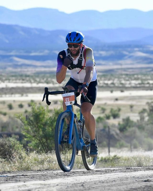
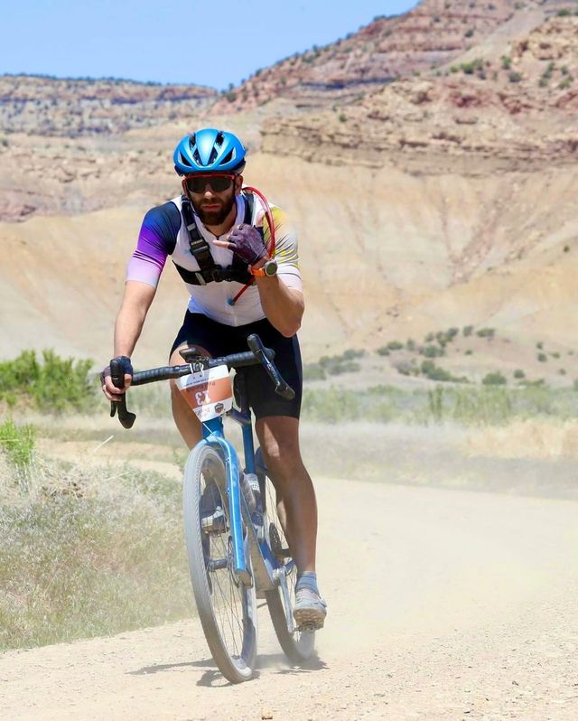
What's even crazier is that for the first time in my life, I have signed up for a bike race! Oh, but not just a single bike race. No siree! I am currently signed up for three different gravel races in 2021. And some seriously challenging ones too:

Is "audacious" the right world? Seems like it might be.

An FTP test last weekend showed that I not only kept my fitness over the winter but actually got a smidgen stronger since last October. And I did a 350 mile week at the beginning of March, so the distances are not too worrisome. Gravel riding over long distances is more jarring and exhausting, but a recent gravel-filled weekend makes me think it is manageable with the right tire size and additional training.

However. Part of me would like to do really well in these races. And, I would definitely like to be so fit that finishing (barring a mechanical problem) is a foregone conclusion.

And so, I have started my first structured training program. It is an 8-week plan written by one of the leaders of her Basecamp group and is meant to improve my strength, resiliency, and ensure I can survive a long, hard day in the saddle.

I am only four days into it and boy oh boy has it already given me a couple decent workouts. Today is a rest day with a relaxing one hour ride before a delightfully hard weekend of climbing and endurance riding, and I very much need this recovery day. Many of the more structured workouts will probably be done on my Wahoo Kickr, but I just bought my first power meter to allow workouts to be performed outside too.

Feels a bit weird to take exercise this seriously, but with races on the calendar and a partner who is kicking ass with her own cycling, I thought it was time to up my own game a bit.


Everesting Take 2: Fuck It All

Mr. Bubbles: And things have indeed gone wrong.

Tina has informed me that I cannot read her blog entry about my second Everesting attempt until I finish writing my own and post it. So, here I am, almost two weeks later, reminiscing about yet another failure. Oh, yippee.

Let’s see. What to say, what to say.

It started early. 2:54am to be exact. It was cold. Mid-40s is my best guess. And it only got chillier as the night went on, thanks to the clear night sky. Obviously, that meant layers. Thermal tights, cold weather biking jacket, a light puffy jacket, long fingered gloves, wool skull cap, buff, and shoe covers. Hot coffee in an insulated thermos, naturally.

Cold weather plus climbing is tricky. Roughly 1600 feet of climbing every hour with an equal amount of descent. Makes it challenging to balance between staying warm and not sweating so much that you get chilled on the fast descent. This meant a fair amount of zipping and unzipping with a regular rotation into dry gloves

The first quarter (12 laps, 7300 ft) went fine. It was chilly but I did a short warm up beforehand and kept myself well fueled with bars and cookie dough. I had plenty of bike lights and the road had virtually no traffic. No animals rushed in front of me this time and while there was some wind, it was not a significant hindrance.

All that being said, it was really nice when the sun rose. Layers came off and my cold feet warmed up in no time. The canyon above Jamestown stayed fairly cool and you could definitely smell autumn in the air. A small amount of leaves had already dropped and a few, eager deciduous trees were already changing colors.

Part of me was a little disappointed that this was not a normal bike ride up in the foothills as it was idyllic in both weather and ambiance.

Around 11am Tina returned and joined me for lap 23 with approximately 13K feet of elevation gain already in the bank. And by noon, I was halfway done. All according to plan.

It sounds good on paper, but in reality it felt less than superb. When I started my first Everesting attempt, I felt strong. My energy levels were good and finishing felt not only possible but almost inevitable. Not sure what was going on with this ride, but I simply never clicked into a good place mentally or physically. I was tired from the start.

Maybe it was the wildfires pumping smoke into the air for weeks beforehand or the consistently hot temperatures in Boulder during August or the stress and exhaustion from working while the entire country seems to be falling apart, but even the first lap felt like effort. You know those rides: you’re there and you’re going to do the time, but it’s going to be a struggle.

And then that damn, stupid leg started hurting again. I cannot emphasize how frustrating it was during the first attempt when it got so painful that I ended up limping for almost a week afterwards. You do months and months of training with literally 100s of thousands of elevation gain, and then on Game Day it decides it wants to break down.

The month between this attempt and the last attempt I really worked on rehabilitating it. Hot baths, massages, stretching, and gradually ramping up to more and more climbing. When Tina did her Everest and I ended up doing 10K of elevation gain with no pain, it seemed like I had recovered sufficiently to try again.

Nope. It started getting unhappy again around 12K of elevation gain. I had modified my segment to take off the steepest section to improve my chances, but by the halfway point it had become a serious concern again. I was getting out of my seat frequently to help stretch it out and reduce the repetitiveness, but that had the consequence of using up more and more of my precious energy.

Somewhere around 15.5K feet of elevation gain, I started feeling pain in my knee again. At 16.5K I was so exhausted from trying to do anything and everything to reduce the discomfort and growing pain that I just threw in the towel. The pain was less sharp than last time, but even so I found walking unpleasant for days afterward.

Blargh. Over 11 hours. All of that biking and no Everest. Again.

Suffice to say, I am not trying again this year. It took me nearly two weeks of recovery to handle today’s Ward ride and I simply cannot fathom losing two more weeks to tapering, especially when the weather is even further against me in October. Nope. Back to fun, shorter, challenging rides in the hills until the snow returns.

I am thinking about getting a Wahoo KICKR to prepare for next year though…

Second to Last Lap
My second to last lap before quitting, clearly not feeling great.

Everesting Interrupted

It has been four weeks since my first Everesting attempt. That attempt ended when an already sore quad was combined with cold temperatures and eight hours of biking to result in serious knee pain. It was extremely disappointing to prepare everything, get over 13K of elevation gain, and then have to quit at 3am because I rushed a bit into my first attempt because of weather concerns.

I spent a few days off the biking completely and also drugged myself with ibuprofen to get the leg and knee less cranky. I eased into some slow, short rides and after a couple weeks was back up to moderate training rides. When I pulled off a SuperJames + Ward ride, I felt I was ready to start considering another attempt.

Last weekend the conditions aligned and Tina made her Everesting attempt on Monday. Despite a couple hours of chilly rain at the end, the majority of her ride went pretty darn smoothly. I actually considered joining her so we could Everest together, but I decided that being her support crew was more important. Many things can go wrong during an Everesting but some of those are addressable with a support crew, so it made sense to have that as my focus. Even still, I joined her for 10K feet of climbing. The leg and knee were a bit sore afterwards but overall they held up without much complaint.

With Tina’s Everesting a success, it was time to start considering my own. Labor Day seemed like a reasonable day to make an attempt. I already had it off from work and it gave me roughly a week to taper.

On Friday, I drove up to Jamestown and did a subsection of my segment twice. My original segment had a third of a mile of 11-14% grade at the end and I am fairly sure that was the root cause of my knee pain. Doing that manner of grade repeatedly in the middle of the night with a sore quad is not relaxing. With my leg still not completely healed, I wanted to consider a segment without that stressful bit at the end. It means an increase in the number of laps to reach 29,029’ but a far kinder grade for my knee.

So, here we are on Sunday afternoon. And, Monday is off the table. A winter storm system is supposed to arrive tomorrow night with snowfall predicted for Tuesday. Preceding the storm, Jamestown is forecasted to have 20-30mph wind gusts starting at noon Monday and lasting for four hours. Not a deal breaker but not exactly encouraging with my leg at less than 100%.

No, what has killed this attempt is our heat wave for the past few days with high temps in the upper 90s and low 100s. Combined with some wind, the forest fires nearby have flared up and smoke has filled the skies of Boulder. We stepped outside 30 minutes ago and the smell of smoke is strong. As I look out the window right now, the mountains are no longer visible.

¯\_(ツ)_/¯

With the shorter days and the nighttime temperatures lowering into the 40s, my window for successfully Everesting this year is quickly disappearing. I also do not wish to lose fun, autumn bike ride for this project. There are other routes I want to do before the weather changes. We shall see what next weekend brings. I may give it two more weeks and then call it for this year.


Tina’s Everesting

Last Monday, at approximately 10:30pm, Tina completed her first Everesting. I provided support throughout the day (3am-11pm) by refilling water bottles, organizing gear, and making sure she never forgot to take a snack. That last one is a fairly easy mistake to make over the course of 19 hours of biking and one that can be a critical mistake given how on top you need to be of your food + hydration.

Her entries are pretty thorough, and I do not feel I need to add much, except a couple of points of emphasis.

  1. It was rather cold in the beginning. In the wee hours, I was working on my computer at the base of the hill and I was wearing a jacket, a winter hat, and wrapped in a blanket…and I was still chilly.
  2. I still ended up pulling off just over four hours of work and 10,400ft of climbing on Monday. Living the dream.
  3. She had a pretty fantastic day for her ride, I am quite envious. The air stayed rather cool and the sun never reached an unbearable level. If it was not for the fact that Sunshine gets a fair amount of vehicular travel, it would have been practically ideal conditions
  4. Except for the last two hours when a cool rain completely soaked us for the last four laps. That was demoralizing. I am so happy that I brought my rain jacket and a towel. Neither of which I expected to use, but without them I would not have been able to do the last few laps with her.

An Everesting Attempt

As last weekend started, the forecast was shifting so that the weather for Wednesday morning in Jamestown was looking less promising for an Everest attempt. Where it had previously been forecasted as partly cloudy with a high in the mid-70s, now it was forecasted to be sunny and in the mid-80s. Given my previous experience during my Half Everest with those same conditions, I knew that was not what I was looking for. I simply do not respond well to hours and hours of climbing in that kind of heat and exposure.

Always optimistic, I decided to hold off on a decision until Sunday morning. That morning I pulled up the forecast and if anything it was going to be even warmer than the forecast we read on Friday night. Well. Shit.

Tina pointed out that the forecast for Sunday night and Monday morning was not bad though. Boulder on Sunday afternoon was going to get into the upper 90s, but the clear skies overnight and the higher elevation of Jamestown meant that my segment’s low temperature was going to reach the low-50s overnight. Rather pleasant for hours of climbing by bicycle. Not only that, the forecast predicted that at noon on Monday, Jamestown was only going to be 73 degrees. Since I was aiming to finish by early afternoon that seemed fairly ideal.

The only problem is that I had been exercising with the expectation that I would not be Everesting for at least three more days. While Saturday morning’s ride had been a moderate effort, the previous week’s rides had been hard with significant personal records (PRs) achieved. As I stood at the kitchen sink staring at the mountains and contemplating my options, my left quad felt sore and tired. Nothing bad but definitely noticeable.

Also, I had absolutely nothing prepared for a possible 17-18 hours of biking that night. Food would need to be acquired, at least one huge bag of ice, gallon containers for water, a few spare tubes, numerous bike lights charged, and then all organized to be findable and accessible in the middle of night. Not an insurmountable problem by any means, but an unexpected bunch of tasks with no time to dawdle.

What really pushed me towards trying Sunday night was the fact that the weather forecast for the rest of the week was rubbish. Hot and clear every single day. Not only that, there was a major wildfire blazing to our east and while we had woken up to smoke and haze on Saturday, Sunday was blessedly clear. There was no guarantee that would last. This was my only realistic chance for the rest of the week. So, I started getting ready.

Almost immediately I started charging my various bike lights. A full night of biking on a mountain road was going to require every single one I owned. Also, all of my bike clothing was in the laundry, so that needed to be started so it could dry before I packed. Then, I pulled out a stick of butter to warm up, so I could make oatmeal chocolate cookie dough, one of my favorite ultra-distance foods. Finally, we took trips to Walgreens, a bike shop, REI, and Whole Foods to get all the food and gear that I might need for such an effort. Given I had gotten two punctures in my rear tire during a ride at the end of July, I did not want my Everest to fail because of a lack of spare tubes. All of these things I had originally planned to do over a leisurely Monday but now the deadline was dramatically moved up.

Prepping at Home
Getting all of the gear and food ready for Everesting

My gear list ended up being nearly 100 items long. Long sleeve bike shirt, short sleeve bike shirt, bike shorts, multiple pairs of gloves, socks, buffs, lightweight rain jacket, puffy jacket for the car, bike shoes, towel, clear and regular sunglasses, five different bike lights, spare tubes, tire levers, bike tool, chamois cream, lip balm, sunscreen, first aid kit, cleaning towelettes (salt chafing is real), headlamps, GoalZero battery, charger cables for watch/phone/lights, WagBags, paper towels, WD40, chain oil, masks, hand sanitizer, and two shopping bags full of bars, gels, and real food. Let’s not forget the large cooler full of iced coffee, vegan protein shake, iced tea, gallons of water, water bottles with Tailwind, cookie dough, bananas, apple, and sliced meat and cheese. Probably had three times as much food as I needed but you never really know what your body will crave or reject on these kind of rides, so it is helpful to have many options.

After an early pasta dinner and catnap, we packed up the cars around 6pm and headed up to Jamestown with the goal of me starting my ride at 7pm. Reasonably quiet roads and cool temps would be my friend, while a lack of sleep and the potential for animals being on the road during my speedy nighttime descents being real challenges. Tina was intending on sleeping in the car and being my support crew. Since each full lap would take me just under 30 minutes, my approach was to stop by the cars every third lap for a fresh water bottle and snack. During those short breaks at the car I would also switch out bike lights, pump up tires, and use the bathroom when necessary.

Suiting up at Car
Getting dressed and readying myself mentally for 18 hours of biking.

It all started reasonably well. The sun was just starting to set behind the mountains and the temperature was just over 70 degrees with little wind and only a hint of humidity in the air. In fact, even though I was trying to be mindful of my speed and set a slow pace, I ended up getting a rather fast PR on my very first lap. Whoops!

As you imagine, you settle into a bit of a routine when doing this many laps on a well known segment of road. You know where you are going to shift gears, where you are going to get out of your seat to stretch your legs, the best spots to take a few sips of water, where you need to slow down as you come into town to avoid hitting the speed bump too fast, and what section of road is just going to be a bit rough on the legs no matter how many times you do it. At the top of every lap, I would take a full drink of water, pull out a black marker to tally the most recently completely climb on a piece of white tape, and then take a bite of whatever food I happened to have in my left back pocket. This mental rhythm really helps.

After my third lap, I came in for my first break and put on my bike lights. It was getting dark enough that I wanted to see and be seen by the 3 or 4 vehicles that sped by me on every lap. And then I went and did my next three laps. Took a break. And then three more laps. Took a break.

At this point, nine laps in, I was a quarter of the way done with my Everest attempt. And I felt pretty darn good. Hydration was going well. The cookie dough was by far my favorite snack whenever I visited the car. And, while I was definitely feeling the effort and late hour, a few sips of coffee definitely helped. There was a bit of a headwind on the last half of the climb but it was manageable. So, I started heading up for my tenth lap.

At the top of the tenth lap, I turned up the brightness of my front light to have the most possible light for the downhill…and it turned off. Oh shoot, I thought, must have held the button too long and turned it off. Nope. The light had died. Here I am, at the top of my climb, on a moonless night, needing to descend, and I had no front light. Fucking. Hell.

When we did the Mt. Hood Picnic last year, I had put both front lights on my handlebars and just switched to the fresh one when the other was getting low. This time, since I had my phone on my handlebars, I had only one front light and had left the second one at the car with the intention to switch it when the first one started becoming dim. Was not expecting the light to fail completely. Guess that is why its button blinked at me a ways back: 15 minute warning.

Thankfully, I had sprung for the fancier back lights, which could be used as either a white front light or red rear light with the push of a button. Otherwise, I would have been rather screwed. Even so, I descended about 10-15mph slower than usual as it provided significantly less visibility than my dedicated front lights. Arrived back at the car, surprising Tina, and put on a new front light. And just to be safe, I put one of my headlamps and a spare rear light in my backpack. Not going to make that mistake again. Way too dangerous.

Did two more climbs and then on my last descent before heading back to the car (lap 12), I spooked a coyote that ran in front of my bike for about 20 meters while I was rapidly descending, requiring a fairly significant amount of breaking and a rear wheel that wiggled a heart skipping amount. Sure you worry about the large, black trucks speeding up and down mountain roads and the oblivious deer or two, but damn that coyote was the real danger that night.

Oh, I may not have mentioned, I have absolutely no cell service on this segment. Not a single bar. 😟

Got back to the car and told Tina about my little Close Encounter of the Canis Kind. Still alive though. And already over 10,000 feet of elevation gain. A third of the way done. Bit of a problem though and one whose significance will grow. My left leg, the one that I noticed was tight and sore that morning? It had definitely warmed up and felt solid for the first 12 laps or so, but now my leg was feeling the climbing. I moved the leg up and around and did some knee hugs hoping it would shake out. Took two extra strength Tylenol as well.

Over the next three laps my left leg got tighter and started causing outside knee pain. Tried to get out of my saddle more to help stretch it out, which only helped a minuscule amount. At the top of my second and third laps, I actually got off my bike and tried various stretches to help it relax and loosen up. Unfortunately, it did not seem to be helping near enough, as the knee pain never went away and got worse on the steeper bits of climbing.

At my next break, I told Tina about my issue and that I was going to try to see how it felt after the next three laps, as it definitely looked like my attempt was going to end if it did not improve. Went to the bathroom, did a few more leg movements, and a bit of stretching before heading off. Around halfway up, I decided to turn around and call it. On a relatively shallow grade (4-5%), I actually started saying “Ow, ow, ow” out loud to myself because of the pain. Damage was being done and another eight hours of biking was not going to help it go away.

A quick descent back to the car and at 3:07am, my Everest attempt ended.

We packed everything up, drove home, and emptied the cars. By about 4:30am I was back in bed with a few ibuprofen in me for the pain and I did not wake up again until just past 10am.

So. I ended up doing just over 13,000 ft of elevation gain on that ride in about eight hours. Except for the leg/knee, I felt pretty damn good and I definitely had the energy and fitness to finish it. That damn leg though.

Four days later and it is obvious I made the right decision to quit my attempt. The next two days both my leg and knee were painful, and I did not even want to do a short walk around the neighborhood. But with a hot soak, stretching, and massaging the leg muscles have started recovering with the knee pain slowly disappearing. Did a 30 minute easy bike ride this morning and it felt ok. Now I just have to get it back in full working order so I can try again. Maybe in two weeks or so.

A few important lessons learned on this attempt.

  • Always carry backup lights at night
  • Bring more than five large spoonfuls of cookie dough
  • If you start with a sore/tired leg, then it is probable that attempting 30K feet of climbing in a single ride will make it worse and you may need to choose a different day.
  • Wear a cool weather biking jacket and/or light pants at night. At 52 degrees, a 40mph descent after a sweaty climb will chill you and your muscles; it may have contributed to the leg tightness issues.

Training for an Everesting

Thanks to COVID-19 and the ludicrously bad response to it by the federal government, almost all organized outdoor events have been canceled for 2020. That included the Double Triple Bypass ride that we signed up for back in January, which was supposed to take place last month up in the mountains near Vail.

That ride is what led Tina and I to make our 500K goal for the year. The rules were simple: 500,000 ft of elevation gain in one calendar year, by any and all outdoor activities. I tried to convince Tina to make it a cool one million of elevation gain, but she was having none of my craziness. I suppose if one is still expecting to work full time, that is a bit ambitious. Of course, she is the one with less than 60K left to go here in the second week of August!

Even with my clavicle being broken and completely losing 5 weeks of training thanks to the resulting surgery, I myself am only 150K away from completing that goal. At current training levels that means I should be finished in early October. Just in time to beat the first snowfall, I hope.

When the Triple Bypass got canceled, we started considering other projects we could attempt, especially since all of the climbing gyms were closed and the local hiking trails were overrun with too many non-mask wearing individuals. Everesting was the most obvious one. It completely aligned with our existing training and was socially isolated. Perfect for the athlete in need of a physical outlet for pandemic stress.

As they say on their website, “The concept of Everesting is fiendishly simple: Pick any hill, anywhere in the world and complete repeats of it in a single activity until you climb 8,848m – the equivalent height of Mt Everest.” For Americans, that is 29,029 feet of elevation gain in one go. Brutal.

The first step to completing an Everesting, at least for me, was doing what is called a Basecamp, or Half Everest. Back on July 3rd, I started off at 4:45am on a Friday morning up in the foothills above Boulder and did 18 laps on a 2.1 mile segment near the town of Jamestown. My ride ended up being 78 miles and 15,000 feet of elevation gain over the course of about eight hours. It was tough. The most challenging part was that the day ended up being quite warm with little cloud cover. I felt positively cooked by the end and when I weighed myself at home, I was 7 lbs lighter than when I woke up.

A week later, for a change of pace, we went over to Idaho Springs and biked up to the summit of Mt. Evans at 14,271 feet high with an almost continuous uphill climb of 6700 feet. That was a hoot. Probably one of my favorite climbs ever. The road is a little rough after Echo Lake though; with regular cracks thanks to the freeze/thaw cycle up high. The downhill ride was less than smooth and gave me quite a headache. Wider tires definitely recommended.

The next step that I wanted to complete prior to attempting a full Everest was doing 30,000 feet of elevation gain in a single week. To be clear, I wanted 30K within a Strava week, which is Monday through Sunday. Upon some prompting from Tina, I discovered that I had already done 32K in a 7 day period (Saturday through Friday) thanks to my Half Everest.

So, during the week of July 20 to July 26, I did a total elevation gain of 30,761 ft. The nice part of that training was that all of my rides were roughly between 4K and 6K of elevation gain. The goal was to keep the effort up continuously throughout the entire week. Train my legs to keep going even when tired.

With that milepost reached, I felt I was at the very least capable of completing an Everest if everything aligned well. So, I started tapering. The next week I reduced my elevation gain to only 14K. Same intensity, less time. And the week following that one, which just so happened to be last week, I aimed to only do 10K of elevation gain.

Enter the end of last week. Thanks to a couple stressful months at work, I decided to simply take this entire week off and mentally recharge. It also meant I had an entire week available to me for an Everest attempt, if the weather looked promising. On Thursday, the 10 day forecast made it seem like Tuesday night and Wednesday morning were looking promising. By Sunday morning, the weather report had shifted and a new plan was put into play.

To be continued…


Missing Things During the Pandemic

A year later, Paul checks back in.

Instead of doing a recap, I will just point out that Tina and I now reside in Boulder, Colorado. Approximately six months after moving here, the pandemic hit and now we are two months into our new life of spending nearly all of our time at home. Not only that, only a couple weeks into that isolation, what should have been a low-key, enjoyable trip to a local bike park ended up with me breaking my clavicle and requiring surgery to set it right.

So...shit!

On one hand, we are extremely lucky in that we both have jobs that allow us to work remote and those positions are fairly stable. On the other hand, this is most definitely not what we imagined our 2020 would turn out to be and it has been a rough adjustment.

No coffee shops, no friends visiting, no hiking in local parks, outdoor trips are canceled, no travel back to the PNW to see friends and family, and so many unknowns about the future. It feels like a weird holding pattern where nothing is real and the future seems almost nonexistent. Welcome to limbo.


A Review of the Picnic Training

Well...this is a bugger of an entry to write. First off, I am not terribly pleased with either Strava or Garmin Connect as a training platform.

Garmin is convenient in that it automatically uploads all activities recorded by my watch and shows significantly more detailed data than Strava does. However, except for their Calendar view (which is superior to Strava's) I simply do not use its website or iOS app very often. Their devices record so much information and their platform is attempting to provide so many features, that you simply get frustrated by how poorly organized everything feels and your inability to view your data in a way that works best for you. My fingers twitch thinking of how I would improve their entire UX and add a handful of critical data visualization tools. Oh, and for the love of god could I please have the ability to add an activity manually? (Update! Tina has shown me where to add a manual activity in the Garmin Connect web application! Woot! She still had to go searching for it, so I think the point stands that their apps have a problem with organization.)

Strava swings the other way. Their pages for viewing an activity are the gold standard in visual presentation. I genuinely enjoy using their iOS app and I find myself reviewing my activities on it immediately upon completion. There is a solid social component to the platform, and its segments and flyby features are truly fun. But. Their primary focus is almost entirely on biking and running, which means other activities are given little attention and Strava's tools frequently ignore them. I find every single Training tool of theirs frustratingly limited. If you want a truly complete picture of your training via powerful search and data visualization tools, Strava does not deliver. I am also still pretty annoyed that they refuse to give users back a chronological feed–a feature they replaced with a "smart" feed over three years ago.

There are two other tools worth mentioning here too. Ride with GPS has really upped their game this past year, and if you are only into cycling I highly recommend it. If they ever expand into other sports, I suspect it would be a fantastic training tool. There is also Training Peaks, a platform designed by people who love entering data in ugly interfaces and then analyzing it with even uglier graphs. I barely last more than a few minutes in their application before I run away. As a UI, it genuinely offends me.

––––

Sorry about that little diversion. While trying to write this entry, I spent time in both Strava and Garmin trying to find a way to easily visualize the last five months of training...and it was frustrating to say the least. So, instead, I will speak in less analytical and more conversational terms.

As a whole, the training went well, perhaps even better than expected. We only decided to start training for the Picnic at the beginning of January, which left us with less than five months to get in shape for what is essentially an Ironman Triathlon's worth of effort. We also decided that we were unwilling to focus exclusively on Picnic training as there were other activities–like downhill skiing and bouldering–that we still wished to continue doing. A challenge to be sure, but doable, especially since Tina and I are normally fairly active individuals.

There were a number of factors that added to this challenge though. Training in winter, especially for biking, is particularly difficult as the weather has a tendency not to cooperate. We had an entire week of snow, ice, and below freezing temps that made road biking for any significant distance impossible. And while we both bought warmer biking clothes, it is hard to push yourself out the door when it is 28 degrees and windy. Oh, by the way, hill climbing with freezing cold air? Hell on the lungs.

Both of us got sick too. I had a sinus infection that took me out of commission for over a week, and it took me nearly three weeks to fully recover both my strength and breathing ability. Then, the biggest challenge for me was the rolled ankle that happened in mid-March at the bouldering gym. The bike trainer and pool helped keep me active, but I lost more than two weeks of solid training time because of it. All and all, with two illnesses and an ankle injury, my true training time was less than four months.

I think in the end, I would have preferred another full month of training. When we walked up to the Columbia River on our first attempt, I felt finishing was possible but I did not feel as solidly prepared as I would have liked. Another few weeks of swimming definitely would have been prudent, especially given how punishing the swim ended up being. More brick days combing multiple activities with longer distances would have helped teach our bodies to push longer when tired too.

In the end, the best way to judge your training is by your results. While we did not do the full Picnic, we still accomplished a significant chunk of it and in the expected amount of time. If we had had time for a brief nap and a pot of coffee, it is quite possible we would have completed the entire Mt. Hood Picnic as planned.

What stands in my mind is how I felt afterwards. The next day, after 12 hours of sleep, I felt pretty damn good. A bit of tightness, a bit of soreness but no worse than I normally felt after one of our hard training days. I forced myself to take a full week off to rest and recover, but I felt completely capable of continuing our training regiment. That speaks to how effective the past five months ended up being. We were attempting to train our bodies to simply grind out hours and hours of exercise without breaking down. It worked.


Mt. Hood Picnic - Part Deux

After our first Mt. Hood Picnic attempt was foiled by wind, windsurfers, and stormy weather on the mountain, we decided to reevaluate our route for the swim and also wait for a more solid weather window before trying again. On Sunday evening, we took a gander at the weather forecast for the coming week and determined that both Thursday and Friday were looking promising. Dan volunteered once again to kayak with us during our swim, providing a welcomed safety buffer on what is perhaps the most challenging part of this little adventure.

No other parties were available to provide support, so we decided to do the picnic self-supported with no crew providing any food, water, or aid. This required that we divide our gear into two parts and use two cars, leaving one at Timberline Lodge and leaving the other at the start/finish in Hood River. Also meant that after the first section of biking, where Dan would meet us to say hi at least once before heading home, we had no real bail out options if things went wrong, say at 1am on Highway 35. So it goes.

Getting to the Start.

Thursday morning rolled around and while there was a chance of light rain on the mountain and moderate winds at Hood River, the forecast otherwise looked good. So, we packed up both cars and drove to Timberline Lodge. Unlike last time–when we had Dan in his kayak, a support person in my car, a friend joining us for the climb, and additional friends planning to meet us at the finish–this time felt decidedly low key.

Dropping off Tina's car at Timberline went smoothly. Found a nice parking spot in the overnight area, filled out the permits to avoid thinking about them later, checked the gear one last time, and then drove my car with the bikes atop down to Hood River.

Driving down, we eyed our predetermined break spots and also attempted to get a feel for the road from a biker's perspective: steepness of the grade, thin or non-existent shoulders, rumble strips, places that still had gravel debris from the winter, etc. I still had concerns about biking along the highway at night, but I kept faith that a Thursday night would be reasonably quiet.

Funnily enough, the first 35 miles or so of driving, there was no wind to be seen. The trees were becalmed. That is until we were about 10 miles from Hood River. Ah, there was the wind. Oh, and look! The windsurfers are out! Yay!

We parked near the Hood River bridge and walked up the shore to one of our possible starting spots, a beach at the very end of the Best Western property. Our thought was that with the strong Columbia River current and the Hood River's inflow, our best strategy was to simply start further upstream. Then, when we reached Washington, we would swim upstream prior to crossing so we would have a healthy buffer of space to get back across.

Thinking it over and seeing the waves, we decided to try our second, more conservative starting spot at Koberg Beach, a full mile upstream of the Hood River bridge. This turns out to have been wise choice.

Suiting up for the Columbia River swim
Suiting up for the Columbia River swim at Koberg Beach

The Swim

We suited up for the swim and Dan drove us over to the Koberg Beach in his car, where we helped him carry his kayak down to the beach. With relatively little fanfare, we put on the rest of our swimming gear, inflated our orange buoys, and got into the water. As with our previous open water swims in the Columbia, we took a minute or two to acclimate to the water temperature and then swam off towards Washington. Our first waypoint for the crossing was the end of a spit that sticks out from the SDS Lumber Company property. After reaching the spit, we would swim around its tip and ultimately land on a sandy beach on the Washington shore.

In only 20 minutes, I reached the spit and was feeling pretty solid. The waves jostled and rolled me a fair bit in the main channel, but after our previous attempt it felt manageable. Simply a matter of timing my strokes and breathing at the right time. Every so often a large wave would catch me, but I simply rolled along with it and kept my mouth shut to avoid swallowing water.

We regrouped at the end of the spit and then slowly swam around the spit checking for boat traffic while avoiding a few large pylons. About 10 minutes later we had navigated the rocks near shore and made landfall. A few photos, a quick snack, and then we were ready to swim back across.

Our endpoint on the return swim was the Best Western beach area, which would give us plenty of space before the Hood River bridge. Since we expected a strong current again, our actual aim was for a tall tree about 500ft upstream from the beach itself.

Tina and I started out together but once we passed beyond the protection of the spit, the waves and current took hold and we both focused on our own swims. Dan was there to watch over us, so we knew someone was keeping an eye on the other person. I think about halfway across is when I realized that the return swim was going to be more of a battle than I had expected. The waves had gotten a bit larger, and it was obvious I was working harder to make forward progress while still being pushed unrelentingly downstream.

Remembering last week's attempt and definitely not wanting to have a repeat, I dug in and just kept swimming. I counted strokes, kicked harder, and kept my sighting breaks as short as possible. The last five hundred feet or so, the current noticeably lessened and the waves got weaker. In what felt like forever (but was only 35 minutes since leaving Washington), I reached the protective log barrier surrounding the hotel's dock and hopped up to check where Tina was.

Tina was a few hundred yards away and swimming close to the bridge, but since Dan was with her I hopped off the log barrier and swam to the dock to finish my swim. Once on the dock, I sat down and took a few seconds to rub out a cramped calf. For a minute or two, I thought I might have to walk off the dock and down the shore to meet Tina, but she pushed hard and made it to the dock only five minutes after me. After a few deep breaths, she hopped onto the dock and our Columbia River swim was complete!

Celebration Post-Swim
Celebrating a successful swim

Biking to Timberline

Dan took our victory photo and then piloted his kayak back towards Koberg Beach. Tina and I took a few more selfies and then slowly walked up to the car. The swim had been damn hard and we both mentioned how much we had struggled to get back across. Tina said that if we accomplished no other activity that day, the swim itself had been a solid achievement. I agreed.

There was no stopping at this point though. Instead we took a leisurely hour to peel off our wetsuits, rinse the Columbia off, drink and fuel up, change into our bike kit, do a couple videos, assemble our bikes, and do the final organization of our packs. Right around 6:45pm with Dan watching, we started our bike ride to Timberline Lodge, only 47 miles and 7300 ft of elevation away.

Paul and Mt. Hood on Highway 35
Scenic views on the bike ride to Timberline

The first hour went smoothly. Our legs warmed up nicely and the climb out of Hood River felt good. Then, right around 8pm, just a minute or so after Tina recorded a video on her bike saying how well things were going, she hit a piece of glass and got a flat. What's even funnier is that we were less than a mile from our first scheduled break spot at the Hood River Ranger Station.

Ladies and Gentlemen, over the next hour and a half, we traveled less than one mile. We replaced her tube with a brand new one and by the time we reached the ranger station, it was losing air. Not in the same spot either. No siree, this new tube got a tiny hole on the opposite site of its valve. Either it had an existing weakness or it got damaged during installation. We first tried to patch this tube but the patch would not hold. So, we patched her original tube and that is the tube she used for the rest of the bike ride.

The sun had set during our little bike maintenance fun, so we put on our bike lights and continued on. Dan promised to meet us at our next break spot at Cooper Spur Rd. just in case we had any further bike tube issues.

Tube Repair at Hood River Ranger Station

The biking at night was simply lovely. The traffic was even lighter than we expected. There was no moon so you could barely see much beyond your front light, which made it so you could not tell how steep the road was or what was too far ahead. You simply biked and kept your eyes on what was immediately in front of you.

We made it to Cooper Spur Rd. in what felt like no time. In fact, we beat Dan there. We grabbed a quick snack, thanked Dan and wished him safe travels home, and continued on our way.

The next segment had a mile section where there was virtually no shoulder and small piles of gravel on the edges. This is the section that concerned me the most during our planning and what encouraged me to buy new, brighter lights to ensure we were as visible as possible to vehicles. The small section went off without a hitch. We were through it in about 7 minutes and not a single vehicle was seen. So much for that.

Our next scheduled break spot was the turn off for Mt. Hood Meadows, but we stopped a couple miles beforehand as it was getting chilly and we both needed to add a top layer. We skipped the Meadows break spot and enjoyed a fast downhill in the dark before stopping again for a quick snack and the adding of a bottom layer and shoe covers.

Up to this point we had seen only a dozen vehicles or so since Cooper Spur Rd. When we reached the junction with Highway 26 and merged onto it, vehicles were on the road almost constantly. It was a bit jarring to go from a dark, quiet highway where I spent most of the ride in the middle of the lane to having trucks zooming past you every minute.

Just after 12:30am we reached the bottom of the Timberline Road and the beginning of our last bike climb of the night. We took a nice fifteen minute break to light up the sign for pictures and fuel up a bit. While the climb up Timberline Road was not bad, we definitely felt tired. We had been going pretty steady for almost 9 hours and had not slept at all. I also think the swim took far more out of us than we expected, which made everything that came after it just that much harder.

The Backcountry Ski

But we made it to Tina's car by 2am and, while tired, we still felt like giving the summit a go. Unfortunately, we were moving a bit slow, so by the time we had eaten our prepared food and drinks, stowed our bike gear, changed into our mountaineering clothes, and organized our gear it was already 3am.

That is a pretty late time to start for a summit climb, especially when you are already dragging. Unfortunately, with the long break after our swim to recover and then the bike flats, we simply were behind schedule and had no time to even take a short nap.

Still. We went up. Just slower than we have ever gone. And, I will be honest, there were multiple times on the way up when I thought I was about to fall asleep on my skis. Just beyond Silcox we agreed that our new goal was the top of Palmer. We were too sleepy and still had a long bike ride back to Hood River ahead of us. Also, it promised to be a bright, sunny day which means lots of sun exposure on the slopes and an increased chance of rock fall higher up on the mountain. Zzzz + meh = nah.

When we reached the top of Palmer, the sun had not yet hit the slopes and, let me tell you, those slopes were pretty darn icy and hard. So, we took a short little nap and waited for the sun to appear and soften up the snow a bit. Even with 30 minutes of sun, the ski down was fairly lousy. Only when we reached a freshly groomed trail below Silcox did we start enjoying ourselves.

Paul on top of Palmer
Top of Palmer snowfield as the sun begins to rise

Biking to Hood River

Getting back to the car was a nice feeling. All that remained was the bike ride back to Hood River. While it was 47 miles, it was almost entirely downhill and we had oodles of time to do it in. But first, we went into the W'yeast Day lodge and took another long break, where we closed our eyes, ate snacks, and drank fluids.

Just after 9:30am, we were all ready for biking and started the fun descent from Timberline. Brrrrr was that descent chilly with the cold mountain air and shade! Thankfully, we were down in no time and the wind + speed woke us right up.

The majority of the bike ride back to Hood River was delightful. It was warm but not hot. There was about 1500 ft of climbing but it was easy to switch to our lower gears and just crank it out. The only exception to this delight was when we approached Hood River, where a headwind made

Hood from White River on Highway 35
Mt. Hood from White River on Highway 35

the flats a bit more effort than we would have liked. Also, our second wind was starting to fade and we were getting sleepy again.

Even with a few pauses for food and photos, we reached the Columbia River in three hours and thus ended our second attempt at the Mt. Hood Picnic.

Epilogue

All said and done, we did 2.1 miles of open water swimming, 94 miles of biking with 8800 ft of elevation gain, and a 2500 ft backcountry ski. That is not too shabby.

However, it is not quite what we planned and that does frustrate me a bit. I would have loved to have gotten that summit too. That was the dream goal and it felt almost within reach.

That swim though, it was really damn hard. There was a distinct moment out there when I thought I might not make it back across to Oregon. Again. Only when I was three quarters of the way across did I know for sure I was going to reach that dock. And then on the bike ride we got three flats, which cost us well over an hour of time. That exhaustion and the loss of time put us in a uncertain position when it came to the climb. The smart choice was to let the summit go and make sure we got home safe.

We are not intending to do a third attempt this year. Honestly, the idea of doing that swim again is unappealing and finding a new goal/project sounds like way more fun. If I ever try to pull off this again, I think starting the swim a few hours earlier would provide a nice cushion for unforeseen issues and allow a possible nap prior to the climb. Also, during this entire adventure, I only had two chocolate covered espresso beans and a cup of tea's worth of caffeine in a sports drink. I think coffee prior to the climb would have been a real game changer too.

We are discussing our next projects right now, so hopefully I will have something cool to share with you soon. Until then, enjoy my Mt. Hood Picnic photos and videos on Flickr.


The Mt. Hood Picnic - A First Attempt

Our idea of swimming back and forth across the Columbia, biking to Timberline Lodge, climbing Mt. Hood, and then biking back to Hood River has always required a 24 hour period when nearly everything aligned perfectly. The weather would have to be favorable both at Hood River and on the summit of Mt. Hood, a vertical distance of 11,000 feet. We would both need to be feeling strong enough to continually exercise for nearly 20 hours straight, while remaining safe and injury free. Finally, multiple pieces of gear would have to work flawlessly.

Last Thursday was not that day.

To start off, Tina had caught a cold nine days prior and still had a congested nose and cough on Thursday morning. Despite much hand washing, I finally caught her cold on Monday and was still feeling under the weather. We felt physically strong but obviously not 100%.

And then the weather. The Hood River forecast a few days beforehand had looked promising, but the closer we got to Thursday afternoon the more obvious it became that there was going to be Wind, with a capital W. The mountain forecast had also started promising, but Thursday morning NOAA reported that there was a “30% chance of thunder-snow” on Mt. Hood with possible wind gusts exceeding 30mph. Oof.

Still, all of our gear was packed up and a fantastic crew were ready & willing to support us. Besides, the forecast is frequently wrong on the mountain and though sick we still felt ready. On Thursday afternoon, we drove to Hood River from Portland and arrived at our starting point behind the Best Western hotel shortly after 3pm. After consulting with our kayaker, we suited up and moved down to the dock. Right before 4pm we got into the water, calmed our breathing from the bracing temperature, and started our swim.

The swim to Washington went reasonably well. The water near shore was mildly choppy and we felt the current almost immediately. By mid-channel, the waves were significant enough that we were timing our strokes to the swells to ensure we were able to both effectively swim and breathe. Tina and I were separated within the first ten minutes and only with considerable effort could either of use our buoys to rise above the waves and find the other person. Thankfully, Kayaker Dan kept us both in sight, which alleviated any real worry. After only 30 minutes, we arrived on the Washington side of the Columbia, safe and sound. I made landfall about 200 feet further downstream than I originally planned, but it was an easy swim up the shoreline to meet Tina. We then continued upstream a bit further and hopped onto a dock to take a breather and eye our return trip.

Washington-side Dock
On the Washington side, discussing our route back to Oregon

The route for our return swim was meant to take us towards the sandbar that is adjacent to the the primary recreation site for all of Hood River (the city). This sandbar is created where the Hood River, flowing down from the flanks of Mt. Hood, meets the Columbia River. While we modified our swim route to compensate for the Columbia River's current, we did not factor in the inflow of the Hood River. Honestly, I simply did not expect it to be strong enough to cause much difficulty. Also, the sandbar reaches out halfway into the river, so that seemed like a nice buffer between us and any trouble. This was not the case...

As we swam back towards Oregon, we both aimed at a point upstream of our final destination to make sure we compensated for the Columbia River's current. Despite this adjustment, we both discovered that we were moving downstream far faster than we were moving across the river. The water flowing in from the Hood River combined with the Columbia flowing around the sandbar was pushing us right back towards Washington. No matter how hard we swam, the combination of the current and waves was making it extremely difficult to get across.

When I realized that I was quickly approaching an area where windsurfers were zooming about, I made a judgement call and reversed course to head back to Washington. Tina had aimed herself further upstream but–as Strava showed later–she was following a similar path to mine. When Dan informed her that I had turned around, she did too.

Paul swimming in the Columbia
The Author swimming in the Columbia River

Reaching the Washington shore was fairly speedy. Unfortunately, my landing spot was down a steep rock slope with a railroad track atop and then another steep, brush-filled hill up to the highway. After a vexing climb up to the road, our support vehicle picked us up and we drove back to Hood River.

Once there, we walked out to the edge of the sandbar and compared our Strava-recorded routes to where Google Maps said we were currently standing. While not exactly close to the sandbar when we turned around, we were probably no more than 500 feet from the first bit of dry sand. Tantalizingly close.

Route of Columbia Crossing
Route of Columbia Crossing according to Strava. Notice how, as we approach the Hood River, we start heading downstream opposed to across.

Back at the car, we mulled over our options. We had already swam two miles and neither of us felt too exhausted, so we could have potentially kept on going. Heck, we even considered trying the swim again as the windsurfers were starting to clear out as dusk approached. However, the wind report for the bike ride seemed unfriendly and the large cumulonimbus cloud covering Mt. Hood seemed to suggest that our climb was unlikely to be successful.

After a bit of hemming and hawing, we slowly decided that we would rather save our energy and try the whole shebang again when conditions were more favorable. That decided, we went out to dinner with our support crew and had some exceptionally tasty beer. Ooo la la!

Early on Friday morning, we woke up and checked the weather station data up on Mt. Hood and also loaded up Timberline Lodge's webcams. The conditions looked pretty miserable. 40mph gusts had been recorded over night and the webcams showed that it was currently raining with the entire area socked in by a thick cloud. We made the right choice. Seems highly unlikely we would have climbed in those conditions and even biking to and from Hood River would have been treacherous.

While disappointed, we intend to try again. We have definitely learned more about how the Columbia River operates near Hood River and have discussed alternative swimming strategies and locations to give us a better chance at succeeding, especially if there are wind and windsurfers about.

Stay tuned.